Tool Search: Add Address
The Add Address Wizard allows users to add addresses to the product with the intent of attaching those addresses to households. These addresses can be within the district boundaries or outside the district boundaries.
 Add Address
See the Add Addresses Tool Rights article for information about rights needed to use this tool.
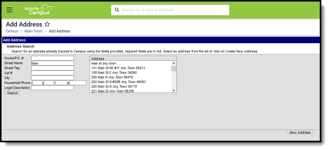
Address Search
The Census module is designed with built-in checks to eliminate the creation of multiple households with identical members and contact information. If search criteria is entered with the same information as an existing household, those existing results display.
The following provides definitions of the available Address Search Fields.
Field | Description |
|---|---|
House/P.O. # | The street location or the Post Office box number of the address. |
Street Name | The name of the street on which the house or building exists. |
Street Tag | Type of street (Avenue, Street, etc.). |
Apt # | Apartment Number of the address. |
City | Town or city where the address is located. |
Home Phone | Household phone number attached to the address. |
| Legal Description | Provides a definition of the address used in Impact Aid reporting when a street location is not available. Each county determines what a legal description is (lot and block data). See the Impact Aid section for more information. |
Search for Addresses
- Enter the search criteria for finding the address.
- Click the Search button. Matching results will appear to the right of the search fields.
- If one of the results matches the desired address, select that address to view details about that address. This changes the view of the interface from the Add Address Wizard to the Address Info tab.
- If results were not returned or the returned results are not the appropriate address, click the New Address button in the bottom right corner of the screen.
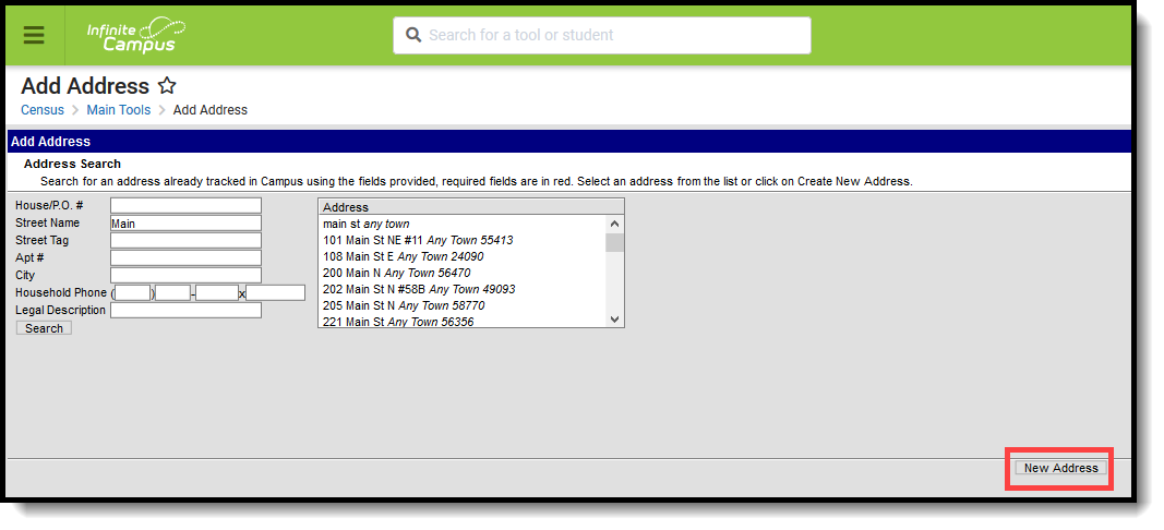 New Address Creation
Add a New Address
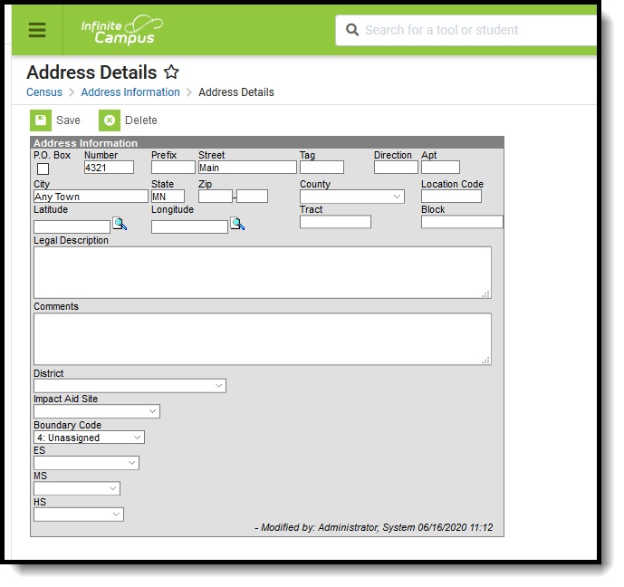
After selecting the New Address button, an Address Information screen displays.
- Enter the address fields in the appropriate areas. See the Address Fields definition for guidance.
- Select the District for where students attend school when living at this address.
- If this new address is on a federal site and the Impact Aid reporting preference is set to yes, enter the Legal Description of the address and select the Impact Aid Site option.
- Click the Save icon when finished.
Upon saving, the interface will change to the Address Info tab where additional details about the address can be added.
 Newly Saved Address
Address Info Definitions

The following table defines the fields available on the Address Info tab.
Field | Definition |
|---|---|
Post Office Box | Indicates the address is not a physical location but a mailing location. |
Number | House Number of the address, or Box number if the address is a P.O. Box address. |
Prefix | Direction of the street in the address. |
Street | Name of the street. |
Tag | Label of the entered street - Avenue, Street, Blvd., etc. |
Direction | Direction indicating the placement of the street within the city limits. |
Apt | Apartment number if this address is for an apartment building location. |
City | Postal city for the address. |
State | Two-digit state code for the address. |
Zip Code | Postal zip code (plus 4 if available). |
County | County in which the address is located. |
Other Address Fields | |
| Location Code | Numeric representation number to accurately locate the address. |
| Latitude | Numeric representation of the address based on north and south placement, generally imported from a district GIS application. Use the magnifying glass to locate the latitude of the address (also referred to as the Geocode). The house number and street name must be populated in order to populate the address latitude. It is also recommended that one or all of the following also be entered:
This field allows for a 10-digit number - 4 digits before the decimal point, 6 digits after the decimal point. The total Geocode value may be up to 14 digits, but only 10 digits saves. If an error message displays, verify the entered values for the address are correct. You may need to change the street name or add a direction. For example, Lexington Ave may need to be entered as County Road 17. |
| Longitude | Numeric representation of the address based on east and west placement, generally imported from a district GIS application. Use the magnifying glass to locate the longitude of the address by clicking the icon next to the Longitude field. The house number and street name must be populated in order to populate the address longitude. It is also recommended that one or all of the following also be entered:
This field allows for a 10-digit number - 4 digits before the decimal point, 6 digits after the decimal point. The total Geocode value may be up to 14 digits, but only 10 digits saves. If an error message displays, verify the entered values for the address are correct. You may need to change the street name or add a direction. For example, Lexington Ave may need to be entered as County Road 17. |
| Tract | Provides a general placement of the address if specific address fields are not available. |
| Block | Provides a general placement of the address if specific address fields are not available. |
| Legal Description | Provides a definition of the address used in Impact Aid reporting when a street location is not available. Each county determines what a legal description is (lot and block data). This field only shows when the Impact Aid System Preference is turned on. See the Impact Aid section for more information. |
| Comments | Provides any additional notes on the address and are for internal reference only. |
| District | Indicates the school district to which students at the address attend. This is often used in school choice settings. |
| Impact Aid Site | Lists any Impact Aid Site associated with the address. When this field is populated, the Impact Aid tool displays the address is part of federal land. See the Impact Aid section for more information. |
